
Rethinking the Commute Beyond Utopian Blueprints
The 15-minute neighborhood is often presented as a grand urban vision, complete with diagrams of ideal districts and promises of effortless access to work, schools, shops, parks, and civic life. Yet the practical question is much smaller and more immediate: can a resident buy groceries, reach a bus stop, visit a clinic, or collect a child from school without starting the car? A useful neighborhood is not created by branding alone. It emerges when ordinary destinations sit close enough together, streets feel safe enough to walk, and regulations allow local businesses and homes to coexist.
For decades, Euclidean zoning has separated residential areas from commercial, civic, and employment uses. That separation may simplify a zoning map, but it lengthens daily trips and makes car ownership a condition of participation. The alternative does not require a single megaproject or a rigid master plan. It requires small shifts, city-scale results: removing unnecessary parking mandates, permitting modest mixed-use buildings, improving sidewalks, and making neighborhood retail possible by right. Regulatory modernization can restore the fine-grained economies that once allowed communities to meet more daily needs close to home.
The Hidden Toll of Outdated Land-Use Restrictions
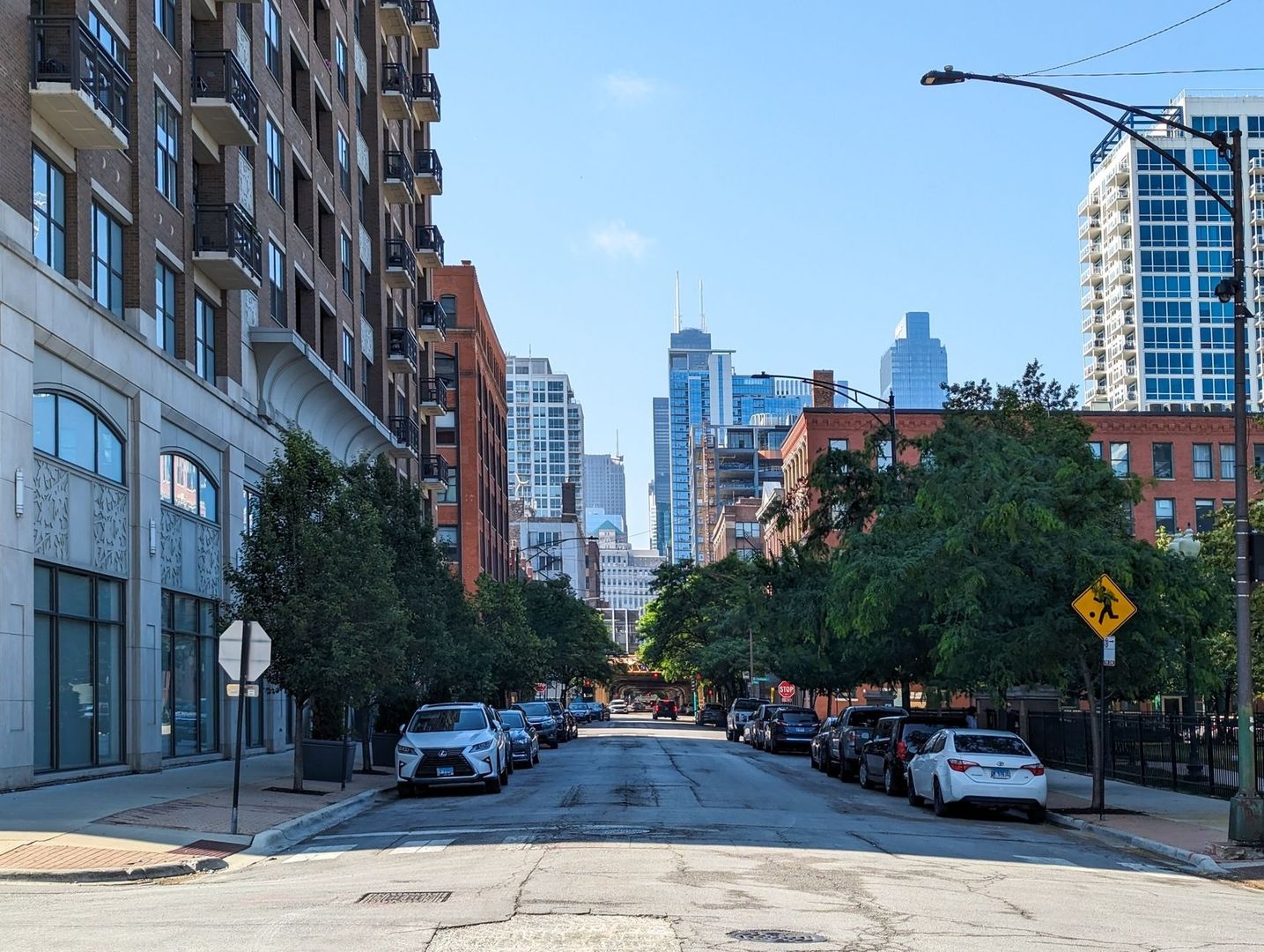
Traditional single-use zoning treats homes, stores, offices, schools, and workshops as incompatible neighbors. Human-scaled neighborhoods take the opposite approach. A corner shop below apartments, a childcare center beside a row of townhouses, or a small clinic near a transit stop can reduce trip distances while adding activity throughout the day. Such places do not need to resemble a high-rise downtown. They can consist of modest buildings, converted houses, and carefully managed ground-floor spaces that fit the existing character of a district.

Car dependency compounds its costs across an entire transportation network. When a grocery store, doctor”s office, and workplace are far apart, each trip generates vehicle miles, congestion, fuel use, parking demand, and emissions. Households also pay through vehicle purchases, insurance, maintenance, and the time lost in traffic. The EPA”s Smart Location Mapping tools help planners compare density, land-use diversity, street design, transit access, destination proximity, and employment patterns. These measures turn the 15-minute idea into something more useful than a slogan: a way to identify where location efficiency is strong, where it is weak, and which investments could make the greatest difference.
Compact, walkable communities with transit and nearby destinations generally offer more transportation choices and can reduce driving-related emissions. Research summarized through the EPA”s smart location initiatives connects efficient locations with lower vehicle travel, household transportation savings, and greater opportunities for physical activity. The Institute for Transportation and Development Policy likewise emphasizes that walking and public transport must function as one network, not as separate policy areas. Still, many neighborhoods cannot add basic amenities because zoning prohibits them, approval processes are unpredictable, or parking rules make a small business financially impossible.
- Single-use zoning increases the distance between daily destinations.
- Parking mandates consume land that could support homes, shops, trees, or public space.
- Disconnected sidewalks and unsafe crossings weaken the usefulness of nearby transit.
- Complex permits favor large developers and discourage small, locally rooted businesses.
The central lesson is straightforward: proximity must be permitted before it can be built. A city does not need to predict every successful business or prescribe a finished neighborhood. It needs rules flexible enough for residents, entrepreneurs, and property owners to create useful combinations over time.
Unlocking Density by Dismantling Costly Parking Mandates
Minimum parking requirements are among the most powerful hidden drivers of automobile-oriented development. A rule requiring a restaurant, apartment building, or office to provide a fixed number of spaces can force a project to devote more land to vehicle storage than to the use that serves people. Surface lots spread destinations apart, increase stormwater runoff, and reduce the number of homes or storefronts that fit on a block. Structured parking may preserve more ground space, but its construction cost can make housing and small commercial projects unviable.
Saint Paul”s parking study found that its former code required more parking than demand justified and offered little flexibility for property owners seeking to convert excess spaces into patios, outdoor retail, or other productive uses. Approximately 36 percent of the city”s land was identified as dedicated to moving and storing automobiles. Reforming those requirements can support affordability, strengthen small businesses, reduce carbon emissions, and make walking, bicycling, and transit more attractive without banning parking or dictating how every resident must travel.
Sandpoint, Idaho, provides a particularly clear warning. A bank”s need for roughly 200 additional spaces threatened neighboring properties in the historic downtown because acquiring and demolishing buildings was cheaper than satisfying the parking formula through other means. The resulting pressure endangered a pizza stand, a coffee shop, homes, and the character of the district, even though public parking was available nearby. After years of incremental action, Sandpoint eliminated minimums downtown, reduced them elsewhere, and established parking maximums. Restaurants expanded, outdoor seating became possible, and development near a grocery store proceeded while parking remained available.
| Policy approach | Effect on land and development | Potential neighborhood result |
|---|---|---|
| High parking minimums | Requires costly spaces regardless of actual demand | More surface lots, higher rents, fewer homes and storefronts |
| Reduced or eliminated minimums | Lets builders respond to local travel patterns | More flexible reuse, smaller projects, and improved affordability |
| Parking maximums in core areas | Prevents excessive vehicle storage from dominating sites | More productive land, better walking conditions, and stronger street life |
| Shared parking and district management | Allows several uses to rely on spaces with different peak periods | Less redundant construction and more efficient parking supply |
Parking reform works best when paired with practical management. Cities can price high-demand spaces, improve loading zones, publish public parking information, and protect accessible parking. The goal is not to transfer every transportation burden to residents. It is to stop treating every parcel as if it must independently store cars for the highest theoretical demand. By recovering land and reducing construction costs, cities give local entrepreneurs more room to invest in people-facing uses.
Bridging the Last Mile with Walkable Transit Networks
Transit cannot deliver a 15-minute neighborhood if the trip to the stop is unpleasant or dangerous. Most transit journeys begin and end on foot, which makes sidewalks, crossings, lighting, shade, curb ramps, and traffic speeds part of the transit system itself. ITDP cites studies finding that 91 percent of transit users in one twelve-city sample walked to a station or stop, while 98 percent walked from transit to their destination. Another study found that 80 percent of US transit users walk to and from public transport. A frequent bus on a hostile street is not a complete mobility solution.
Cleveland illustrates why proximity and quality must be addressed together. City planners began mapping access to everyday amenities in 2020 and found that some neighborhoods had reasonable geographic proximity, but access was uneven and routes were often inadequate. In response, the city pursued a Complete and Green Streets Ordinance, parking reforms near frequent transit, and a proposed Form-Based Code for pilot neighborhoods. The approach recognizes that vacant lots, surface parking, and depopulated districts cannot be transformed by transit frequency alone. Buildings, public spaces, safe routes, and local services must reinforce one another.
Public skepticism deserves a practical response. A 15-minute neighborhood does not confine residents, eliminate cars, or require identical buildings on every block. It expands choices. Moderate density can place more customers near local businesses and support better transit, while careful design can protect privacy, manage noise, and preserve meaningful public space. The strongest response to NIMBY concerns is not dismissal, but clear standards for building form, affordability, parking management, construction impacts, and neighborhood safety.
- Prioritize continuous sidewalks, accessible curb ramps, and frequent, visible crossings.
- Use traffic calming, protected bicycle lanes, and safe intersections near transit stops.
- Support micromobility with secure parking, clear operating rules, and equitable access.
- Pair new housing with trees, shade, lighting, benches, and well-maintained public space.
- Measure access by neighborhood and income, not only by citywide averages.
Safety is both an infrastructure issue and a trust issue. Residents are more likely to walk when routes feel predictable, destinations remain active, and public agencies respond quickly to maintenance concerns. Investments that appear small, such as a raised crossing or a protected bus stop, can determine whether a transit network works for older adults, children, disabled residents, and people carrying groceries.
A Tactical Playbook for Neighborhood Scale Transformation
Municipal leaders can begin without waiting for a comprehensive redevelopment scheme. The first task is to identify where existing rules create friction. A permit that takes nine months for a small café, a parking formula that blocks an apartment conversion, or a prohibition on retail in a neighborhood center can matter more than a large vision document. An audit should compare approval timelines, fees, required studies, parking ratios, occupancy rules, and building-code barriers for small projects as well as large ones.
- Map administrative friction. Review recent applications for accessory units, corner stores, childcare facilities, conversions, and small apartment buildings. Record where projects were delayed, denied, or redesigned because of avoidable requirements.
- Legalize modest mixed uses by right. Permit accessory commercial units, home-based services, neighborhood retail, and ground-floor shops in appropriate residential and corridor zones, subject to clear limits on noise, loading, hours, and safety.
- Modernize parking policy. Remove or reduce minimums near frequent transit, allow shared parking, set sensible maximums in high-access areas, and manage public spaces based on actual demand.
- Test public-space changes quickly. Use temporary pedestrian plazas, shared streets, parklets, and weekend open-street pilots to evaluate designs before committing major capital.
- Sequence reforms visibly. Start with changes that produce immediate benefits, publish performance measures, and use the results to build support for more substantial zoning updates.
Community boards should be treated as partners in design rather than final-stage audiences for a completed plan. Residents can help identify unsafe crossings, vacant storefronts, missing services, and blocks where a small public-space intervention could make a noticeable difference. Pilot projects should include clear evaluation criteria, such as pedestrian counts, business activity, traffic speeds, accessibility, emergency access, and resident feedback. Evidence makes the conversation more productive than arguments about abstract density.
Incremental reform also helps prevent mixed-use planning from becoming a luxury development strategy. Large projects can provide parks and amenities, but they may take decades to complete and can raise concerns about displacement. Block-by-block changes allow cities to support existing businesses, add housing in smaller increments, and target public investment where access is weakest. Affordability requirements, anti-displacement measures, tenant protections, and transparent land disposition should accompany zoning flexibility when market pressure is high.
The most effective sequence is often simple: permit more useful activities, remove the rules that force excessive parking, improve the walking routes, and then measure what changes. This is street-level sustainability in practice. The objective is not to impose a finished lifestyle, but to create the conditions under which convenient, low-carbon choices become ordinary.
Building Thriving Communities From Block to Borough
The 15-minute neighborhood becomes credible when it is treated as a regulatory project rather than a utopian blueprint. Eliminating parking minimums can recover land and lower development costs. Allowing mixed uses can bring daily services closer to homes. Safer sidewalks and stronger transit connections can turn proximity into actual access. None of these changes is sufficient alone, but together they create cumulative gains in convenience, affordability, public health, local commerce, and emissions reduction.
The next opportunity may be a planning board hearing, a zoning code audit, a transit corridor meeting, or a neighborhood association agenda. Civic advocates can ask which rule prevents a vacant storefront from opening, which parking requirement blocks housing, and which missing sidewalk makes a nearby bus stop effectively unreachable. Planners can invite residents to evaluate small pilots with measurable results. With practical reforms and sustained attention, daily life can become less dependent on long car trips and more connected to nearby places. That is how thriving communities are built, from block to borough.